History of the Railroad Article 8

The Building of the Railroad
The building of a railroad does not start with the laying of a single rail. It starts with a team of surveyors, engineers, topographers and axe man.
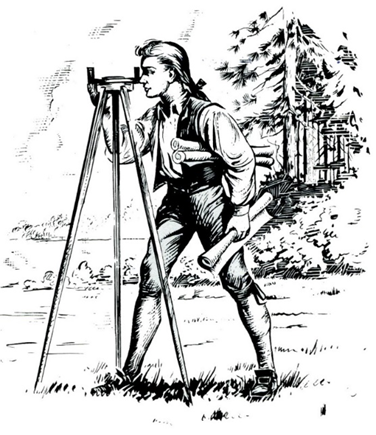
Youthful George Washington Surveying
National Park Service, U.S. Dept. of the Interior, not credited.,
Public domain, via Wikimedia Commons
Their job is to go out and to locate the best position for the proposed line. Finding the straightest, least number of streams, rivers, ravines to cross, along with the best route through the hills and mountains.
The route was very important. The topography, or detailed description or representation on a map of the natural and artificial features of the area, 1 is very important. If the route has too many hills, valleys, gorges or rivers, it will not make sense to route the railroad this way. There would be too much infrastructure needed such as, bridges, trestles, culverts and switch backing. These cost money and after they are built, maintenance and repair would also play a major factor in operating expenses. All this would not make it feasible monetarily to build the railroad on this route.
So, a civil engineer, hopefully a good one, along with a crew would layout a route that financially is the most likely cost efficient to operate.
The full survey party consisted of:
- Civil engineer
- Chief of Party
- Front flagman
- Axe men
- Transit man
- Chainman
- Flagman
- Leveler
- Rodman
- Rear Axman
The civil engineer had the responsibility of plotting out a route that was the shortest, cheapest and straightest. The route that avoided tunneling, cutting through mountains and sharp curves. The picture below shows an example of cutting through a mountain to keep the gradient less than 2% rise.

Cutting Through A Mountain
New York Public Library, Public domain, via Wikimedia Commons
This is very important, for wear and tear upon the locomotive and its efficiency.
To get a better perspective of the layout of the land, the engineer would at times be lowered over the face of a mountain in a boson’s chair to get a clear view of the large section of the route. It helps to see the overall lay of the land. Helping in making the right decision and just how they would lay out the road.
The surveyors came first. A transit man who was responsible for operating the transit, which is an instrument for measuring angles and distances. He was aided with the help of the chainman and froward flagman. The transit men recorded the data, that the topographer would use to draw the maps that were so vital in the map making process.
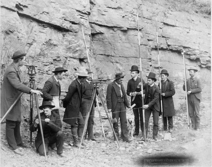
Deadwood Central R.R. Engineer Corps
John C. H. Grabill, Public domain, via Wikimedia Commons
The front flagman would take his corps of axmen to clear the route of trees and brushes. This would allow the transit man to measure out the road clearer. Then along with the chainman he would take his measurements.
The axe-man, after clearing the path would makes the wooden stakes for the transit man (surveyor). The Surveyor would use these stakes to layout the path for the leveler to take his measurements. Also, for the construction crew who followed, for the building of the roadbed and the laying of track.
Chief of party: this position organizes and coordinates the work of the survey party to perform the design, surveys, construction, staking and is the overall supervisor. He also referees conflicts in personnel matters and ensures the camp is set up and running smoothly.
The topographer assists the chief of the party when needed. He also takes the recorded measurements from the transit man and the leveler, entering them into his journal on the topography of the landscape of the country. Topography is the study of the forms and features of the landscape. He sketches the contour of the hills and the direction and size of the rivers.
His detailed maps feature the contour of the land which includes the mountains, hills, creeks, elevation changes, valleys and lakes.
All the jobs on the survey crew are important, but the topographer’s map making ability extremely helps corporate see the layout of the land where the railroads were being built.
The cost and quality of the line is directly proportional to the quality of the survey team. It is their responsibility to properly locate the most level course possible. This saves fuel, wear and tear on the locomotive, cars and infrastructure.
In a new uninhabited land, the straight line, that's flat is the cheapest line possible. It would also have the least graduates as possible or a rise in elevation of the track. The locomotive would use less fuel and water, saving operating expenses and time.
The train of the 19th century could not transit up an incline of little more than 2%. So, sharp curves had to be avoided. Along with staying away from hills and ridges to avoid having cutting through them, to keep the tracks as level and straight as possible.
Ravines were either filled or bridges would have to be constructed. Avoiding major lakes and rivers, that would require the building of bridges, trestles, culverts and revenues. When it came to crossing rivers, they looked for a place to cross with the least amount of difficulty.
Snowstorms were also observed with great concern, when building the transcontinental railroad, snow drifts were of great concern. In the Rocky Mountains the snowdrifts could reach up to 20 feet. They would cover the road and prevent trains from passing. Snow sheds were constructed between tunnels and areas where the snow drifts where drifts were known to accumulate.

Concrete Snowshed circ. 1917
Scan by NYPL, Public domain, via Wikimedia Commons
The biggest reason a railroad ran into financial difficulties was poor preplanning. That is not taking the time to survey the route properly, staking out the route and then having the construction crew follow it.
In his book The American Railway: Development, Management and Trains, Thomas Curtis Clark put it this way. It must be remembered that a cheaply constructed line can be rebuilt, but a badly located line, nothing can be done except to abandon it entirely. Not doing the job properly can be costly.
It is extremely important to locate the line near streams and rivers. Locomotives needed large amounts of water to operate. Also, people and livestock required the same amount.
A level roadbed is very important to provide a stable ride for the train and passengers and for their safety. If the roadbed is unstable, this could cause the train to derail. Also, just for a smooth ride.
If laid out correctly, towns would spring up after the completion of the road, with the railroad choosing where the depots would be placed. They were usually near a good supply of water for the thirsty locomotives. Families and livestock also needed the same amount of water to survive.